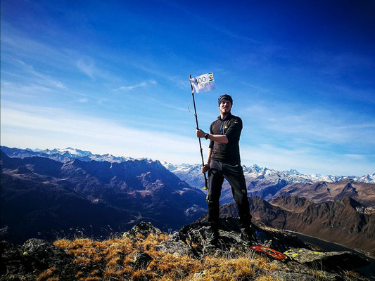
Poncione pro do Rodùc (CH) - 2 507 meters
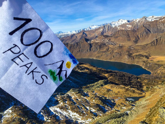
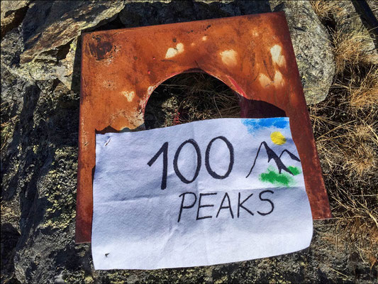
Nr 100 !!
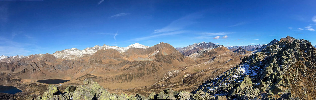
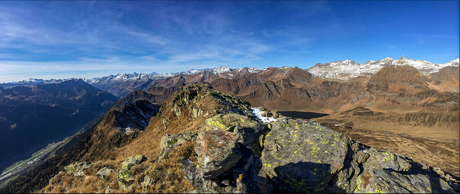
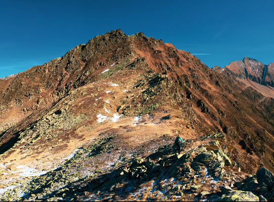
The peak is listed at page 227 of the 3rd Book of the CAS Guides about the Ticino-Region (Dal Passo del san Gottardo al Pizzo di Claro) and was the last one of today's 4 peaks "end of higher mountains without snow" hike (Forca-Poncione d'Arbione-Uomo d'Arbione-Poncione Pro do Rodùc).
There are two separated peaks and both are nominated in the guides, interestingly as it often happens here in this region, the "official" peak is the lower one (2'522 and 2'507 meters). To be sure, I went on both of them :-)
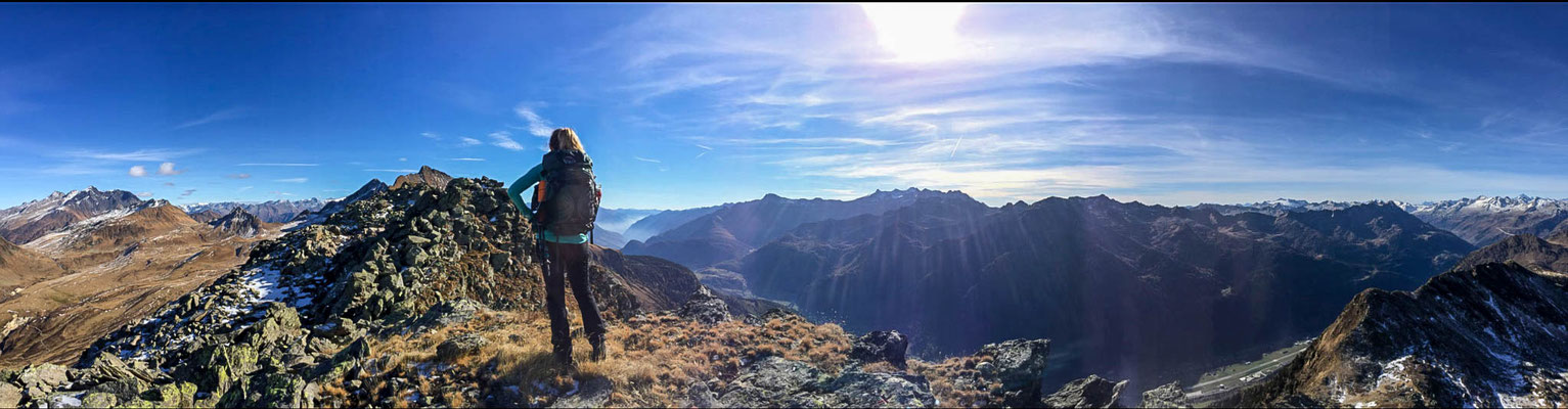
I would say that this mountain clearly was the goal of the day and the other peaks before basically weren't more than the path that led us to it.
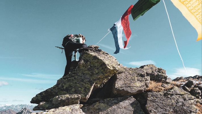
Why?.. because yes, it actually happened, I've reached my 100th peak today... and when I think of the fact that this type of hiking has actually started out of a mood one sunny day a bit more than a year ago, I can't believe how quickly you fall for the attraction of the mountains.
So far, this was obvious to me only in winter but look at me now, even without snow I am happily playing around up here.
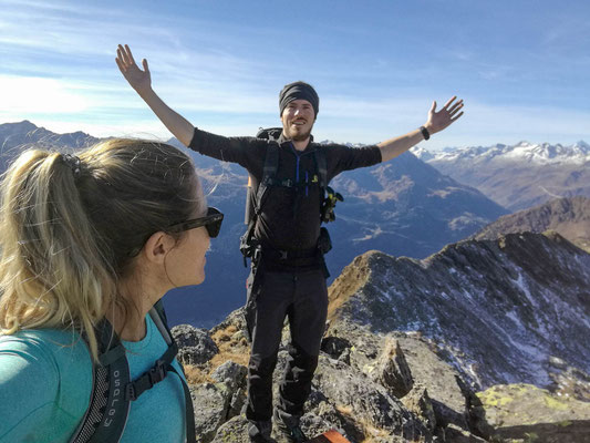
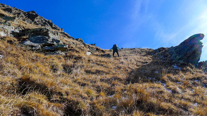
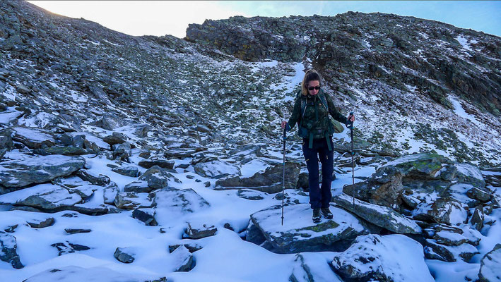
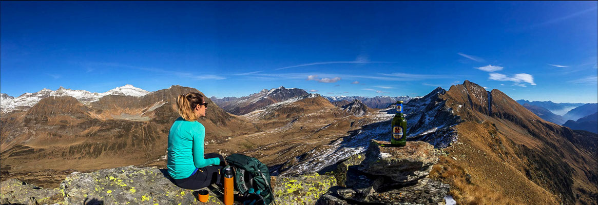
I couldn't have chosen a better peak for my 100th. It was a beautiful day, I had great company (as almost always thanks to my girl) and it was also one of the most challenging ones so far. Very steep walk up (with a small vertical climbing section) and a very steep and slippery walk down on a rocky ground covered in snow which took us almost more time then hiking upwards.
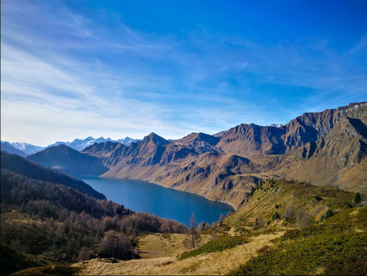
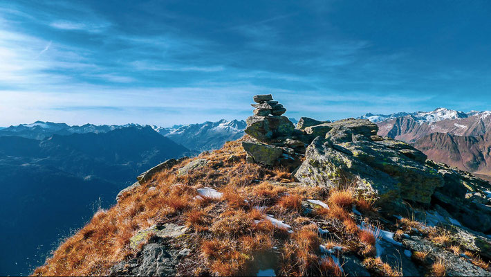
Actually the whole hike was just great and I'm sure that it's likely that I will repeat it one day. I had never seen "my" mountains from this angle so far and also the Ritom Sea resulted to look completely different from this side..even though I had already seen him so many times.
It's also only the second time in all the reached peaks so far, where I'm not only giving a Hiking level but also a mountaineering and climbing level.
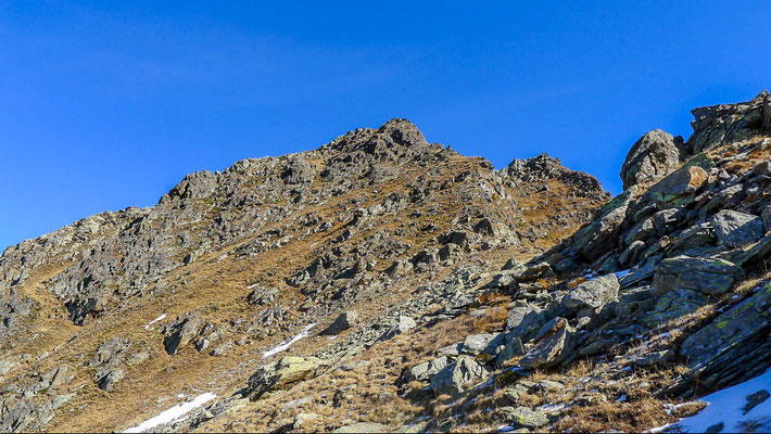
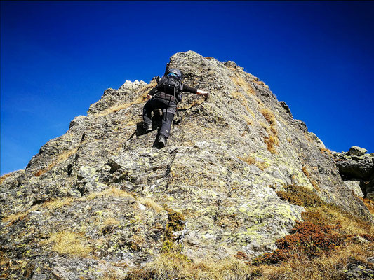
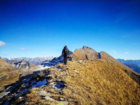
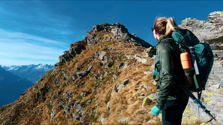
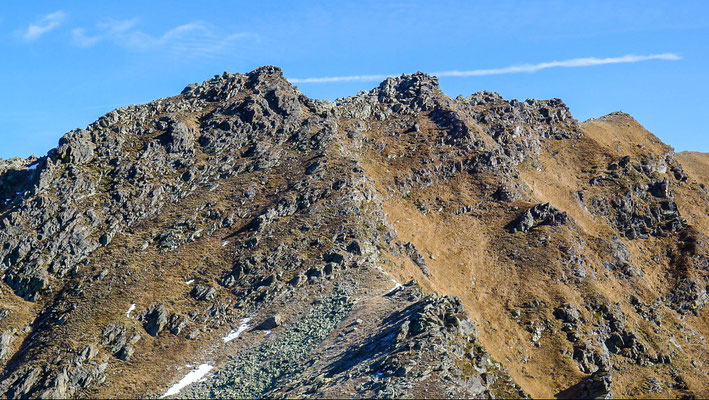
Regarding the grading below, someone who wants to do this walk as well needs to be aware that the peak is really steep (pic 15), there is no path whatsoever and you're always in danger of falling down a hundred meters (minimum), moreover the last section is a 8-10 meters rock which needs to be climbed and on which you cannot allow yourself to loose balance, the result of a slip could be really unpleasant (picture 4).
Hiking Grading: T5 -
Mountaneering/climbing grading: II (LD)
With Katrin
ROUTE: