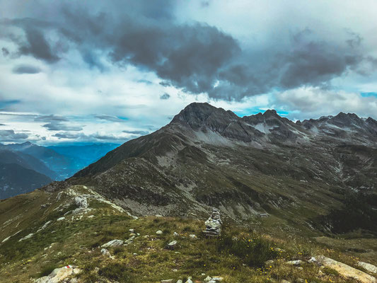
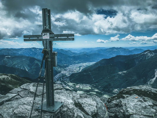
Pizzo di Claro/Visagno (CH) - 2 727 meters
Nr 120
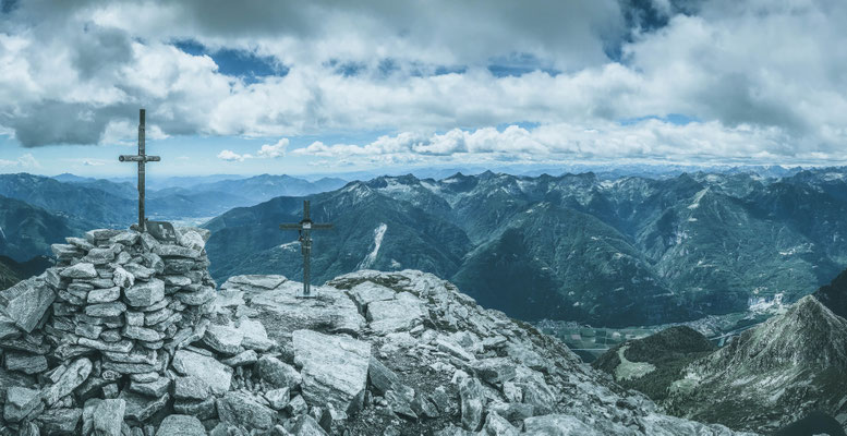
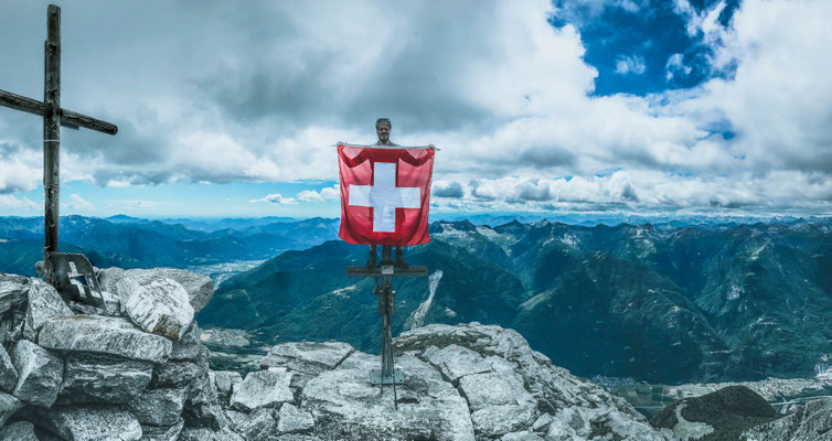
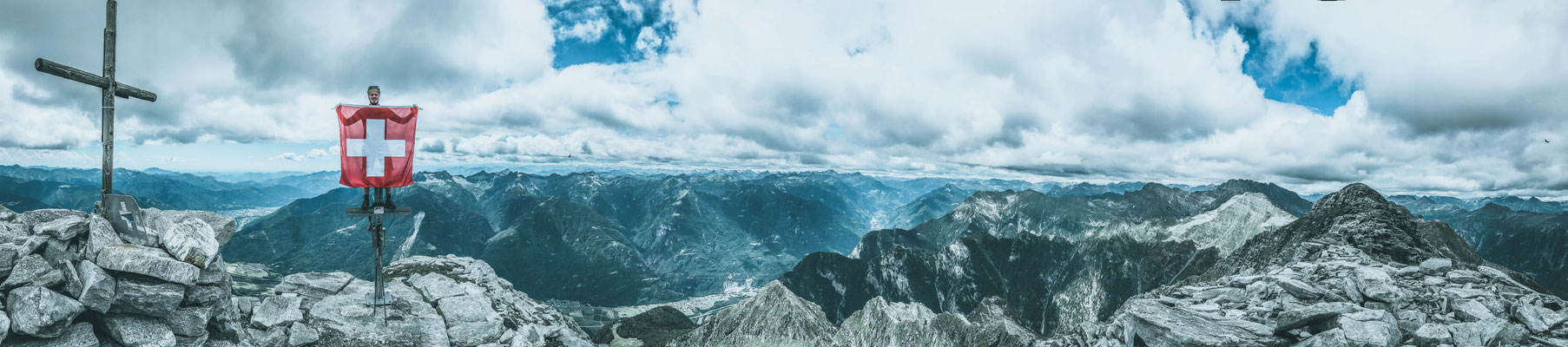
100th summit in Switzerland
The Pizzo di Claro is a very famous mountain in Ticino.
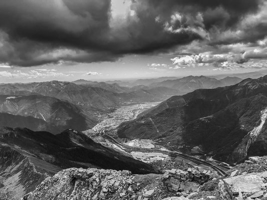
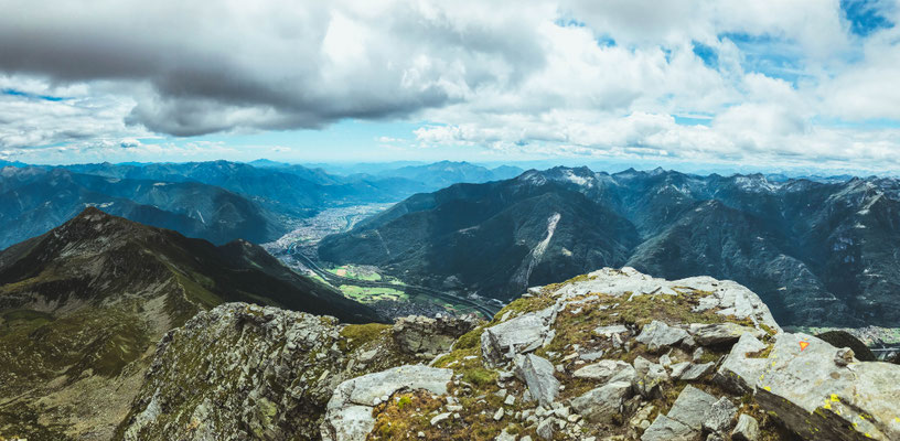
It's the highest mountain around the capital Bellinzona and is probably also the mountain where the difference in altitude from valley to mountain top is the greatest (2,500 metres) in the Ticino Region. In fact, there is also a skyrace which takes place here which is known beyond the national border.
This peak was the second of two today (Piz de Molinera - Pizzo di Claro) and is listed at page 675 of the 3rd book of the Swiss alpine Guides of the Ticino alps (Dal Passo del San Gottardo al Pizzo di Claro).
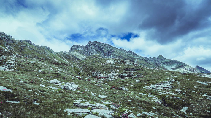
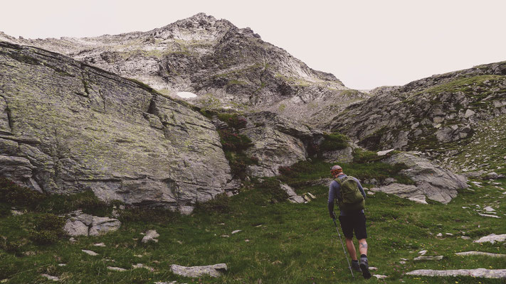
The path we took to come up here is a mix of different ones explained in the guide and I actually found it during an online-search. Once up at Piz de Molinera, we walked to the Passo di Mem and from there took part of Path number 1061 until P.2277, from there we went straight up the hill following Path 1075 (b) to the peak. Descent was then made on the North-western side, where we found a very steep way down following path 1083 which passes the Canee Lake first and then from Alpe Peurett, we took path 1080 to capanna Brogoldone and from there 1,5 hours back to our car. It sounds complicated? It is if you don't have the guides or a map in your hand, it's not once you have studied it as you always should before an adventure like this (be aware that we have seen only 5 humans the whole day).
A little detail: between Piz de Molinera and this one we also passed by Pizzo di Morinere. This one is not listed in the official guides but is marked as a little side peak on the Swiss Mountain map., having said that I still decided to not count it in my list.
It's the second of two today where I took this decision, also because as said in the comment to the peaks in the U.S., I have to balance out the reached peaks as not all the ones in the U.S where real mountains. I'm almost there..
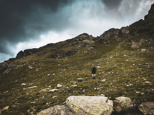
I wanted to hike up to this mountain for a long time now, but then I always chose different tours or something else came up.
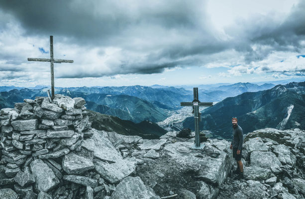
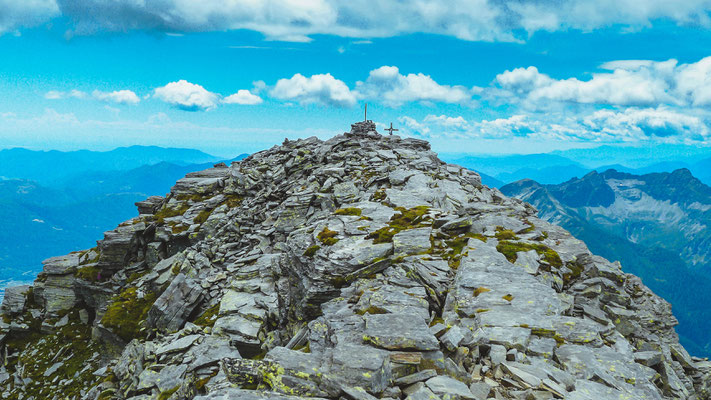
Today, however, it finally worked out and the tour which we chose was anything but easy, in fact it was very strenuous (sorry Pietro) :-), and this although we did not start from the bottom of the valley. As can be seen on the pics below i brought a Swiss Flag with me today and the reason for it was really simple as it was the 100th peak in Switzerland for me! Great feeling and really cool achievement..who would have thought that when I started this project.
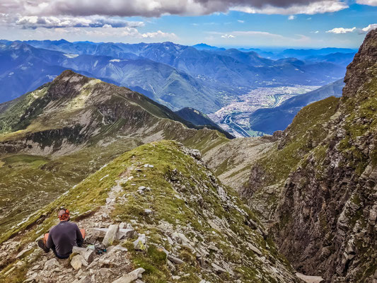
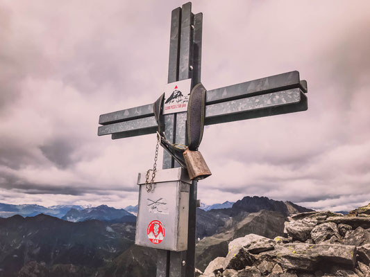
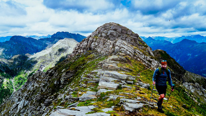
Regarding the peak itself, there is a northern and a southern peak, where the northern is a bit higher but all mountain crosses and books are on the southern one. I think the reason for that is very simple: the view. To be sure i went up on both of them as they are very close.
It's a hard walk up here and you need to have two things: good body shape and no fear of heights, it's really steep and at some points there is a slight risk of a fatal falldown..nothing too extreme though, you can do it!
Level: T3+
With Pietro
ROUTE: